Google Maps update will help commuters plan their social distancing

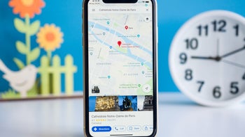
Google never stops working on several key apps. One of these is Google Maps which no longer is limited to turn-by-turn directions. Google Maps will also show you places to go and things to see wherever your travels take you. It also shows you more enhanced walking directions in AR and recently launched Maps' "Plus Code" that allows users to share their precise location with friends and family.
Google now offers crowdedness data for buses and trains in real-time
Today, Google announced that the iOS and Android version of Maps will receive an update allowing users to discover in advance how crowded a train or bus is (a mobbed train or bus could raise the risk of catching COVID-19) or whether a bus or train is running on a limited schedule. Google says that essential workers need this information to get to their jobs and others will want this data too as more countries reopen.
Last year Google added "crowdedness predictions" in Google Maps that used crowdsourced data from tens of millions of riders to help Google forecast how crowded a bus or train line would be at a certain time of day. Now, Google is making it easier for users to contribute to this data. Look up Directions, tap to see Transit Details, then scroll down to find crowdedness predictions where it is available. There, users can enter their own experiences.


Google is also adding notifications and alerts about any COVID-19 checkpoints and restrictions along your route. This will appear even when you're driving across national borders starting with the U.S., Canada, and Mexico). If you're driving to a medical facility or a COVID-19 testing center, Google will remind you to verify eligibility and facility guidelines so that you're not turned away.
Google says, "Getting from A to B can be more complicated these days. Because of COVID-19, it’s increasingly important to know how crowded a train station might be at a particular time or whether the bus is running on a limited schedule. Having this information before and during your trip is critical for both essential workers who need to safely navigate to work and will become more important for everyone as countries around the world begin to reopen. COVID-19 has certainly impacted the way that we move around in the world. As cities and countries across the globe adapt, we’re committed to bringing the most pertinent information right to your fingertips. So when you’re ready and able to, you can safely venture out."
If for some reason you don't have Google Maps on your phone, you can install it from the App Store for iOS devices, or the Google Play Store for Android devices.


Things that are NOT allowed: