Google already uses AI to provide detailed wildfire boundary tracking in Search and Maps, even sending out location-based push notifications. However, now, the company is expanding this tool, making it even more accessible.
Wildfire boundary maps expand to new countries in Europe and Africa
Wildfire tracking is already up and running in places like the US, Canada, Australia, Brazil, Argentina, Chile, and Mexico. Now, as we face a record-breaking summer, Google is rolling out its wildfire boundary tracker to 15 more countries across Europe and Africa, including:
Greece
France
Italy
Spain
Portugal
Andorra
Bosnia & Herzegovina
Croatia
Cyprus
Kenya
Monaco
Montenegro
Rwanda
Slovenia
Türkiye
Google's AI-powered wildfire tracking model is trained using data from various sources, including satellite imagery. The company cross-checks its wildfire model with its own fire scar maps—shapes formed after a fire has been contained—based on data from past wildfires. Other AI models are also used to confirm the presence of fires. This combination allows for more precise and reliable identification of wildfire boundaries than using satellite images alone.
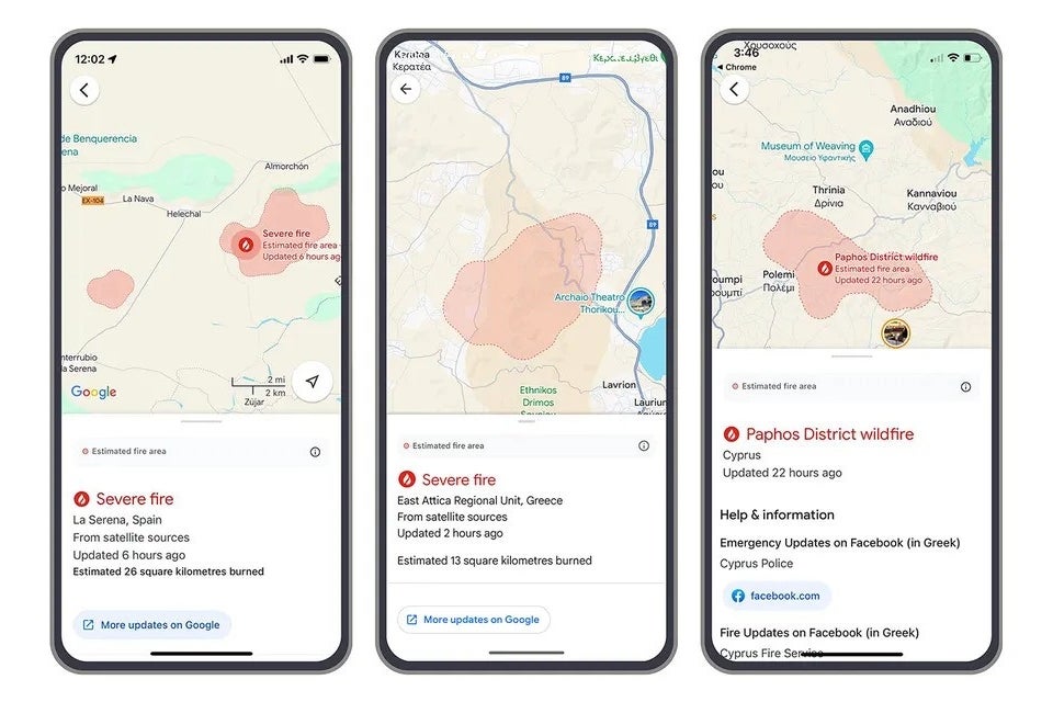
Wildfire boundaries are shown in Search and Maps. | Image credit – Google
Google displays wildfire boundaries on Search and Maps and keeps users updated with notifications. The company reports that in the first week of July, during a surge of wildfires across Europe and Africa, its wildfire information reached up to 1.4 million people.
Wildfire boundary tracking is set up to help both locals and tourists who might not speak the local language. Notifications are customized based on user settings and preferred languages, so travelers can get timely wildfire updates in their own language.
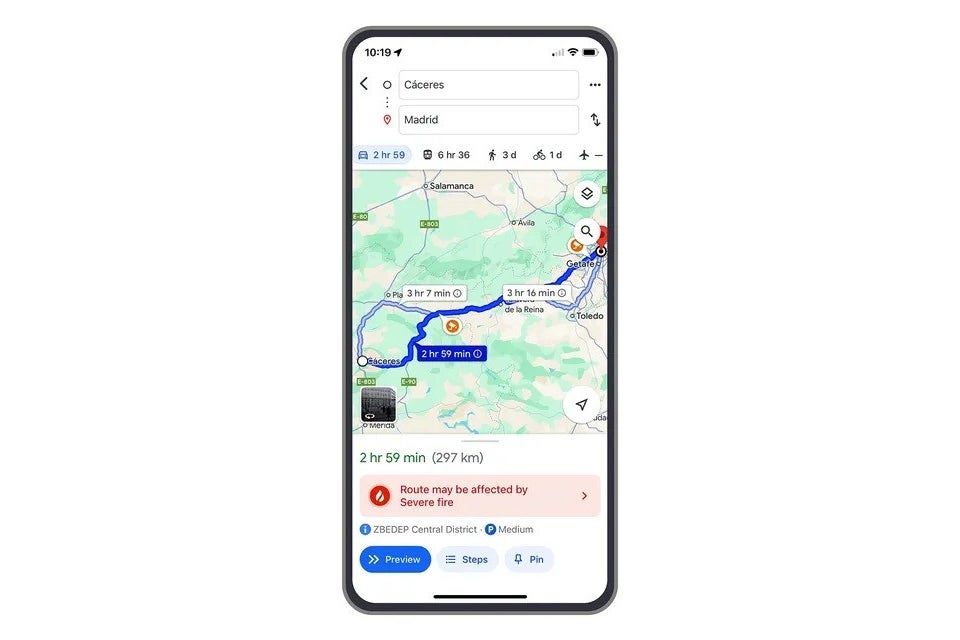
Information about wildfires is also shown on Google Maps driving directions, so travelers can see if there are any fires near their route.
Google Maps driving directions also include wildfire updates. | Image credit – Google
With mobile tech being a part of almost everyone's life these days, it is great to see companies finding new ways to make it useful. With tools like these, technology truly proves its worth in challenging situations. For instance, just recently, Apple’s Emergency SOS via Satellite feature helped rescue four hikers stuck on a glacier surrounded by wildfires.
Did you enjoy reading this article?
There's more to explore with a FREE members account.
Tsveta, a passionate technology enthusiast and accomplished playwright, combines her love for mobile technologies and writing to explore and reveal the transformative power of tech. From being an early follower of PhoneArena to relying exclusively on her smartphone for photography, she embraces the immense capabilities of compact devices in our daily lives. With a Journalism degree and an explorative spirit, Tsveta not only provides expert insights into the world of gadgets and smartphones but also shares a unique perspective shaped by her diverse interests in travel, culture, and visual storytelling.
A discussion is a place, where people can voice their opinion, no matter if it
is positive, neutral or negative. However, when posting, one must stay true to the topic, and not just share some
random thoughts, which are not directly related to the matter.
Things that are NOT allowed:
Off-topic talk - you must stick to the subject of discussion
Offensive, hate speech - if you want to say something, say it politely
Spam/Advertisements - these posts are deleted
Multiple accounts - one person can have only one account
Impersonations and offensive nicknames - these accounts get banned
Moderation is done by humans. We try to be as objective as possible and moderate with zero bias. If you think a
post should be moderated - please, report it.
Have a question about the rules or why you have been moderated/limited/banned? Please,
contact us.


Things that are NOT allowed: