Apple reveals airports and metro areas with malls that feature indoor navigation with Apple Maps
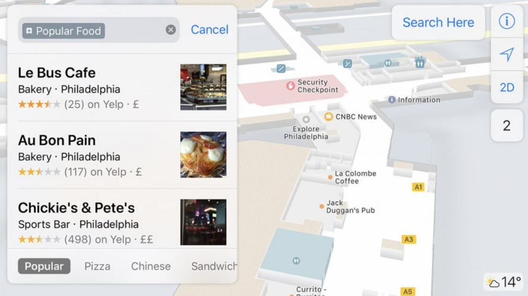
Apple Maps indoor map of Philadelphia International Airport
With the release of iOS 11, Apple Maps started offering indoor navigation for some large malls and major airports. Today, Apple revealed the name of different locations where you can turn to Apple Maps to get from point A to point B. That can be broken down to 34 airports and 9 metropolitan areas inside the U.S. where malls can be found with support for indoor mapping with Apple Maps.
The metro areas that feature malls with indoor navigation on Apple Maps include the following:
- Baltimore, Md.
- Boston, Mass.
- Chicago, Ill.
- Los Angeles, Calif.
- New York, N.Y.
- Philadelphia, Penn.
- San Francisco, Calif.
- San Jose, Calif.
- Washington, D.C.
Unfortunately, Apple has not revealed the names of the individual malls that allow shoppers to navigate the facility using Apple Maps.
The 34 airports that have indoor navigation are:
- Amsterdam Airport Schiphol AMS
- Baltimore/Washington International Thurgood Marshall Airport BWI
- Berlin Tegel Airport TXL
- Berlin Schönefeld Airport SXF
- Chicago O'Hare International Airport ORD
- Chicago Midway International Airport MDW
- Denver International Airport DEN
- Detroit Metropolitan Wayne County Airport DTW
- Edmonton International Airport YEG
- Geneva Airport GVA
- Hong Kong International Airport HKG
- Houston George Bush Intercontinental Airport IAH
- Houston William P. Hobby Airport HOU
- Indianapolis International Airport IND
- Jacksonville International Airport JAX
- Las Vegas McCarran International Airport LAS
- London Heathrow Airport LHR
- London Gatwick Airport LGW
- Los Angeles International Airport LAX
- Orange County John Wayne Airport SNA
- Miami International Airport MIA
- Minneapolis-Saint Paul International Airport MSP
- Nashville International Airport BNA
- New York John F. Kennedy International Airport JFK
- New York LaGuardia Airport LGA
- Newark Liberty International Airport EWR
- Oakland International Airport OAK
- Philadelphia International Airport PHL
- Pittsburgh International Airport PIT
- Portland International Airport PDX
- San Diego International Airport SAN
- San Jose Norman Y. Mineta International Airport SJC
- Seattle-Tacoma International Airport SEA
- Vancouver International Airport YVR
Apple Maps got off to a poor start with certain locations mislabeled and some directions even led users to high risk areas. CEO Tim Cook even recommended that iOS users install third party mapping apps, like Google Maps, until Apple fixed its mapping app. The debacle led Apple to remove its then head of software Scott Forstall and name Jony Ive to take over software design. Since then, Apple Maps has improved greatly although most would still say that it is still playing catch-up to Google Maps.
source: Apple









Things that are NOT allowed: